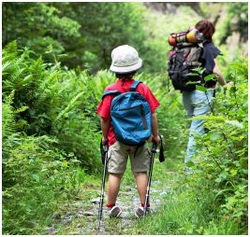
Lake Allatoona Hiking Trails
|
Lake Allatoona hiking trails are steeped in history from the battles of the Civil War.
With the invasion of Sherman's army upon the Allatoona area the grounds surrounding and now know as Lake Allatoona were home to a very fierce battle know as The Battle of Allatoona Pass on October 5, 1864. This trail located outside of Allatoona Landing Marina among others in the area are marked with history information signs. Happy Hiking! |
Corp of Engineers Trails
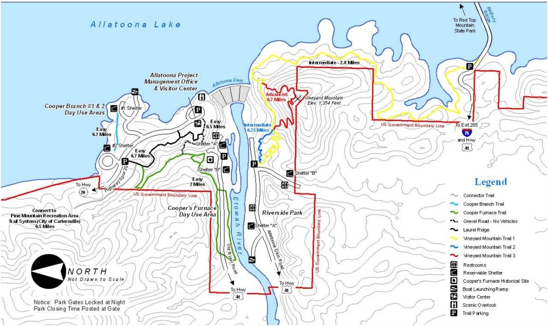
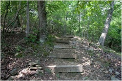
Click Picture To Enlarge
|
Cooper Branch Hiking Trail
This is a short connector trail that provides beautiful views of Lake Allatoona and is rich with wildlife habitats.
The trail is .3 miles which makes this an easy and relaxing hike with a few moderate hills.
You can start you hike in Copper Branch Day Use area #1 or #2. Cooper Branch Day Use Area #1 also offers a boat dock and ramp, grills, picnic tables and one picnic shelter.
|
Daily Parking: Fee: $3.00
Hours: 7am until 9pm daily Accessible: Yes - Ramp to the entrance Difficulty: Easy Address: 1121 State Route 20 Spur, SE Cartersville, Georgia 30121 Phone: 678-721-6700 |
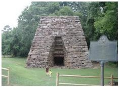
Copper Furnace Trail
The cold blast furnace is the only remaining memorial left standing that represents a major part of the City of Etowah. All of the rest of the iron manufacturing facilities were destroyed by Union Forces during Sherman's Atlanta Campaign in 1864.
The city of Etowah was included as a part of the land which created Allatoona Lake at the top of the Dam, in 1949 the lake started to fill and left this city below over 100 feet of her waters.
To Learn more about this historic area before you start your hike visit this website CLICK HERE.
Cooper Furnace trail winds around the route of the 19th century mining railroad, crossing the road and follows the river shoreline back up to the furnace. This trail will provide you with an overlook above Cooper's furnace along with an abundance of wildlife habitats.
You can enter the 2 miles trail at Cooper's Furnace Day Use Area, this is located across the road from Cooper Branch #2 Day Use Area.
The day use area also has picnic tables, grills, pavilions, boat ramp, multi-purpose field and horseshoes and volley ball areas.
|
Hours: 8am until 6pm - Vary by season
Address: 1052 Old River Road, SE Cartersville, Ga. 30121 Accessibility: Yes - Parking and Ramps Difficulty: Easy Parking: Single Cars Only - No Trailers Allowed Phone: 678-721-6700 |
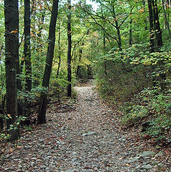
Laurel Ridge Trail
This trail crosses slopes of the beautiful foothills of North Georgia. As you walk the trail you will find a wide variety of trees and an abundance of Mountain Laurel on the way to the ridge overlooking the Etowah River Valley.
Breathtaking views of the Blue Ridge vistas can be seen as you cross over two short steep grades. The trail is is one mile in length one way and has a compacted soil surface.
You can enter this trail at the road leading to the Allatoona Lake Operations Project Management Office and on the service road behind the office, there are sign pointing the way.
|
Hours: 8am until 4:30 pm
Difficulty: Easy Address: Allatoona Operations Management Office 1138 GA Highway 20 Spur Cartersville, Ga. 30121 Phone: 678-721-6700 |
More trails coming soon!
